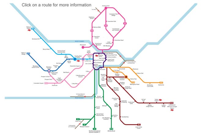
To download an enlarged, printable pdf version of this map
click here

Reading's cycle network connects all the town's major public facilities, employment and leisure areas with almost 37 miles of principle routes, of which 17 miles are segregated from general traffic.
Here's why more and more people are
choosing cycling to get around Reading:
- Getting there fitter - Cycling is one of the best forms of exercise.
- Getting there on time - In Reading cycling is, particularly at peak times, more reliable and frequently faster than travelling by car.
- Get there for less - No fares, no fuel, no road tax, no parking charges.
- Getting there safer - Reading's cycle network aims to improve safety for cyclists, providing off-road, segregated and quieter routes.
- Getting there sustainably - Cycling is environmentally friendly.
Detailed maps of Reading cycle routes detailing facilities on each of the routes and of the full network, including linking routes are available on this site for view and download and in printed form from council facilities.
Reading is also currently served by three national cycle routes that link with Reading's network for long distance travel as well as a route - NCN 422 between Newbury and Windsor that is being designed. Find out more about the NCN Routes
here.
In 2012 Reading introduced a series of mapped leisure rides utilising the Reading Cycle Routes network, the NCN routes and connecting cycleways.