To download an enlarged, printable pdf version of this map
click here

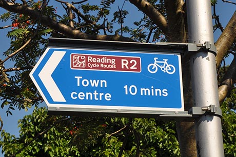
The Reading Cycle network is signed throughout the town with routes converging on the central area. Cycle routes are principally indicated by signs and markings. They may be either on the carriageway or footways, either shared with or segregated from pedestrians, or specially designated cycle paths. A Reading-wide map of the cycle network, with an enlarged town centre illustration, is regularly updated and printed. It is available in printed form (A2 format) from the civic centre, libraries, sports, leisure centres and other channels. The map can also be downloaded from this page. The map shows designated routes and illustrates the nature of the route: dedicated cycleway, quiet on road route, off road track and shows cycle parking facilities. Maps of each route giving more detail can also be downloaded from this site and are also available in hard copy from council facilities. The scale of the maps does not enable every on-route facility to be shown. Typically on the routes you will find the following measures put in place to benefit cyclists:
Toucan Crossings
These are special traffic signals, similar to pelican crossings. They have a red man and green man to show when it is safe to cross, but they also have an extra signal, a green cycle. This means that cyclists need not dismount, but can cross over at the same time as pedestrians.
Advanced Cycle Stop Lines
Within ordinary traffic signal junctions, there are two sets of stop lines on each approach. The one further from the signals is for general traffic, and the one nearer to the signals is for cyclists. This is to give space for cyclists wishing to turn right to safely change from the nearside to the offside.
Contra-Flow Cycle Lanes
When a one way street is introduced this gives little inconvenience for motorists, but can mean cyclists have to travel much further. A contra-flow cycle lane lets a cyclist travel against the direction of flow in safety and offers a more convenient direct route. The problem is that for a safe contra flow, the cyclists must be segregated at each end from the oncoming traffic by a traffic island. This can only be done if the road is wide enough. It may also need to have a parking ban throughout the length of the contra flow lane. This can be difficult in many residential areas with little or no off street parking.
"Plug" No Entry
This is where a road is two way throughout its length except for a short length of one-way working at one end. This means that entry into the road is banned at one end and traffic is only allowed to exit. To assist cyclists a short gap allows cyclists to travel past the no-entry signs.